Panama
Forever more we’ve all heard about the Panama Canal so I thought it would be worth checking
out. Turns out to be a very interesting place. Panama has three and a half million people and
is slightly smaller than South Carolina. Until 1904 it was a province of Columbia but when
Teddy Roosevelt couldn’t work out a deal to his satisfaction with Columbia to buy the rights to
build a trans-isthmus (from the Atlantic to the Pacific) canal, he and the U.S. supported a local
revolution for “independence” and the country of Panama was born. (David McCullough has a
fascinating and well-written history worth reading: “Path Between the Seas”).
Interestingly, and counter-intuitively, Panama as a country runs primarily from east to west and
the Canal cuts across it from north to south. You are actually further west when you are on the
Caribbean (Atlantic) side than when you are on the Pacific side. The country is mostly jungle
and there is a couple of hundred mile stretch in the east where there are no roads and potential
transit on the Pan-American Highway is stopped dead – you have to take a boat around to
Cartagena (Columbia) if you want to drive from North to South America.
The Canal itself is “only” 48 miles long. There are two lakes in the middle of it connected by
sections of canal and five locks that raise (and then lower) ships a total of 86 feet to make it from
sea to sea. It was a huge – and sometimes horrific – ten-year engineering project completed a
hundred years ago (in 1914) and was (is) a boon to world shipping. They can put 40 ships a
day through the Canal and you need a reservation because of the volume of traffic; a boat transit
takes about 12 hours. They are currently making the canal wider to accommodate some of the
new super tankers that won’t now fit through.
A ten-mile wide “Canal Zone” (five miles on each side of the canal) ran through the middle of
the country and was controlled by the U.S. until 1999 when it was seeded back to Panama. The
metro Panama City (PC) area has a population of 1.2 million and is at the Pacific end of the
Canal. Colon, on the Caribbean coast, is 220,000. A railroad initially built in the 1850s runs
between the two cities (mostly) along the Canal. An interesting day of sightseeing in a van along
the canal from PC to Colon to Portabella, and back by train, gives an opportunity to see wild life
(monkeys, sloths, many birds) as well as get a sense of the country and the canal. A second half-
day tour of the Gatun locks and parts of the lake/canal was also interesting.
After two days in PC we flew to David (pronounced ‘da-veed’) near the western border with
Costa Rica and did white water rafting. Rapids were fun and sufficient to throw four of twelve
people out of our two rubber rafts on a half-day excursion. The rainy season is supposed to end
by mid-December, but that was not the case when we went the last week of the year in 2012. We
got rained out of a 12-Tower Zip Line tour in Boquete, then proceeded on a three-hour drive over
the mountains to Bocas del Toro, a small tourist community on an island a half hour boat ride off
the Caribbean coast. Bocas is a nice little town for snorkeling, hiking, drinking and napping. I’d
recommend the seven room Bocus Inn; very quaint and friendly.
All-in all, I’d say Panama is worth a visit – probably best in Jan/Feb/March. The Panama Canal
is part of world history and commerce; might as well go see it. The pictures are by Colleen
Rafferty.
Michigan State University International Photo Competition
Alumni Division
People's Choice Awards
(Displayed in the MSU International Center)
2009: Tibetan Kid and Friend
The Tibetan Plateau

2010: Carrot Top
Bobo-Dioulasso, Burkina Faso

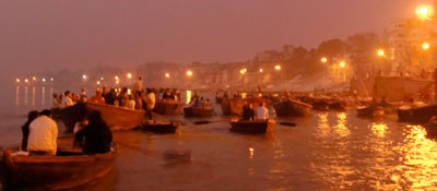
2011: Pre-dawn on the Ganges
Varanasi, India